


Route planning and understanding pilot charts
Where can we stop for a cold beer?

What is the best route to take when crossing the Atlantic Ocean from east to west? Where will we find the most favorable winds regarding force and direction? Where are the ocean currents going? What time of the year is it safe to set sail? Understanding weather systems on a larger scale is crucial when sailing across oceans.
The trade wind
The wind and ocean currents have a clockwise rotation in the North Atlantic due to the Coriolis effect. (The direction of air and water flow is deflected due to the spinning of the earth). The warm air near equator rises and goes north towards cooler air. As it cools down it descends back to the surface of the earth at about 30°N, creating a high pressure system. The cooled air then drifts towards the low pressure area by the equator. This is the trade wind!
The trade winds have provided trusted routes for merchant ships for half a century. You may opt for a more direct route further north, but this may lead you into unfavorable weather such as strong winds on the nose or being becalmed on days end because you're sandwiched between wind systems. Go south to catch the trade wind and current to get you across for a safer and more pleasant voyage.
Pilot charts
Studying pilot charts will give you much needed information when planning an ocean passage. The pilot chart depicts information of average weather for a given month of a given geographic region. Information found in these charts is a result of data collected over hundreds of years from captains’ logbooks. Pretty awesome!

There's a lot of information to be studied in the pilot chart, but I focus on the blue wind roses and green current arrows. The blue wind roses show prevailing wind directions and force, and the number in the middle, a percentage of calm days. The arrows are vectors and replaced by a percentage number if the arrow would otherwise be too long. The feathers represent force. It is not a forecast set in stone but giving you an average of observations. The green lines show the direction of ocean currents and the corresponding number, the strength.
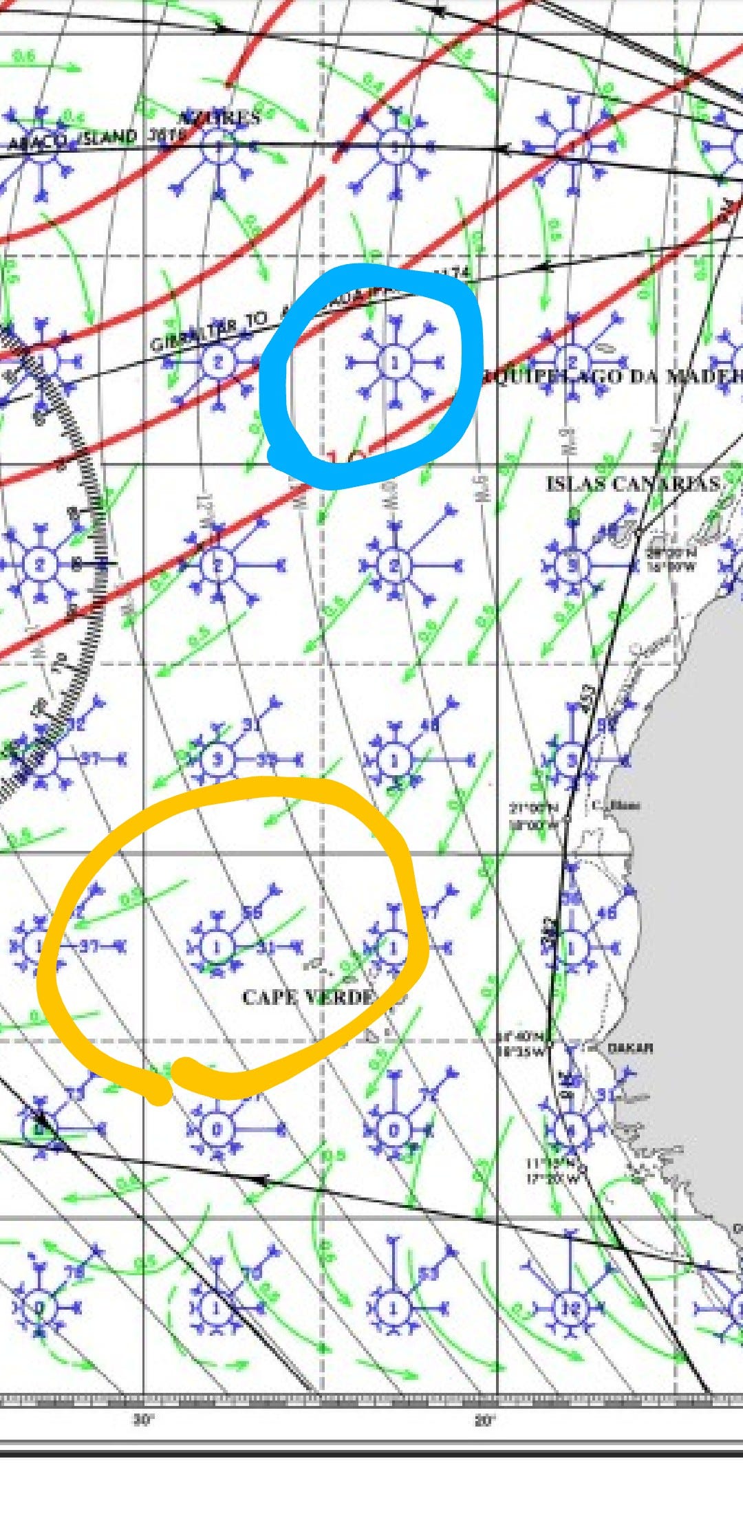
The pilot charts also suggest routes, called the great circle routes, which are the shortest distances across an ocean. We ought to remember that when we cross the Atlantic we are not sailing across a flat ocean as presented on the charts. Instead we are making it across ⅙ of the surface of a globe! The distance between longitudes is shorter the further away from the equator you go. What appears to be the shortest route as drawn as a straight line on a small scale chart may in fact not be the shortest route after.

Tis the season for hurricanes
We are at the peak of hurricane season as I am writing this post. The storm systems have traveled across from the coast of West Africa for months. This season, they have made a turn north instead of making landfall. Knock on wood. This is due to the positions of the high pressure systems in the Atlantic and the Caribbean, making a highway for the storms to travel north (a spinning system on a spinning earth prefers heading north in this part of the world). Storms will always take the route of least resistance. Come October and we'll find the cold fronts from the north meet with the warm waters of the Caribbean Sea, making it a hot spot for tropical systems to form in this region.
By the end of November the hurricane season is over. Hundreds of sailboats will have already made it across from The Canaries before Christmas. The tropical sailing season is on!
Our planned route
Miss Lucifer II made it safely to the Canaries a couple of months ago. She will be hauled out and get a paint job before officially handed over to me. I will meet up with the crew in January before we set sail.
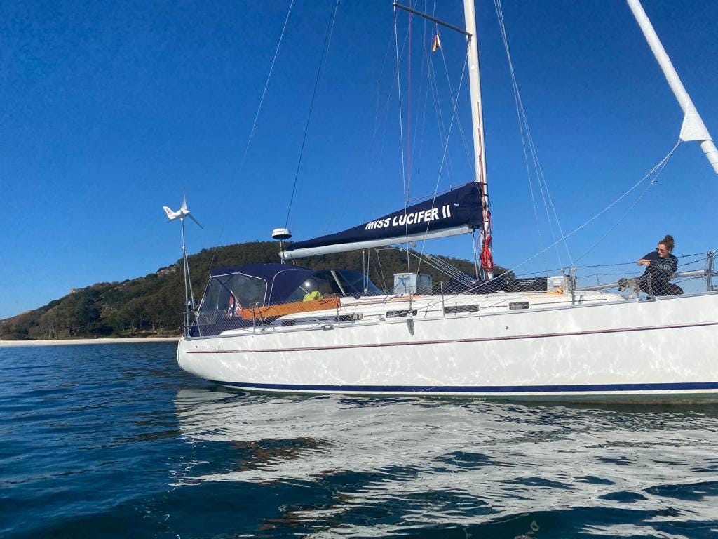


Øyvind sent me this little video as they were on the last leg south to the Canary Islands. The wind was blowing 35 knots, but Miss Lucifer ll steadied on with bravura performance.
We will sail in a southwesterly direction from the Canary Islands. We may even stop in Mindelo, Cape Verde for a cold beer and some fresh produce, before heading west into the sunsets. We will most likely make landfall in the British Virgin Islands or Turks and Caicos before heading northwest to The Bahamas.
Follow us on our voyage, we are super excited!